


Long Island
Long Island is a low, narrow island in the quiet south-western corner of Poole Harbour in Dorset, lying off the Arne peninsula beside its neighbour Round Island and close to Ower Bay. Poole Harbour is one of the largest natural harbours in the world, and its western reaches, fringed by heathland, reedbeds and saltmarsh, are far wilder and less developed than the busy waters around Poole Quay and Brownsea Island.
Landscape

Poole Harbour is a drowned river valley, flooded by the rising sea at the end of the last Ice Age, and it is remarkably shallow: away from the dredged shipping channel its average depth is less than half a metre. Four rivers drain into it, the largest being the Frome, which flows past Wareham. At low tide great expanses of mudflat appear around the southern islands, cut by winding creeks, and Long Island, true to its name, is a long, low strip of land edged with saltmarsh and scrub. From the island there are views across the water to the heaths of Arne and the Purbeck Hills beyond.
History
People have used Poole Harbour for thousands of years. In 1964 dredging off Brownsea uncovered the Poole Logboat, a ten-metre boat carved from a single oak around 300 BC, one of the largest of its kind found in British waters, and archaeologists have found the remains of Iron Age stone jetties near Green Island, showing that the southern harbour was a busy trading place long before the Romans. The Romans themselves used the harbour as a base for their conquest of southern England, with a port at Hamworthy.

In modern times the harbour has kept a surprise beneath its southern shores: the Wytch Farm oil field, one of the largest onshore oil fields in western Europe, has wells hidden among the trees and heath around the harbour’s edge, and pipelines run beneath the harbour bed. In March 2023 a leak from a pipeline spilled oil into the harbour near Ower Bay, close to Long Island.
More about Long Island
Long Island is one of a cluster of small islands in the southern harbour, with Round Island, Green Island and Furzey Island nearby, and the much larger Brownsea Island to the east. Because the water around them is so shallow, the shape of the shoreline changes dramatically with the tide, and at low water the islands rise out of a wide landscape of mud and sand.
Visiting

There is no public access to Long Island, but it can be seen from the RSPB’s Arne nature reserve, whose viewpoints at Shipstal Point look out across the southern harbour, and from the water on boat trips and wildlife cruises from Poole Quay. Kayakers and sailors exploring the harbour should keep to the channels at low tide, avoid landing on the islands and keep well away from roosting and nesting birds. You can collect Long Island as a sighting in your Island Passport.
Wildlife and area
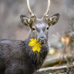
The harbour’s mudflats and saltmarshes are internationally important for birds. In winter, flocks of avocets, black-tailed godwits and other waders feed on the mud, and Poole Harbour has become one of the best places in Britain to see spoonbills. In summer, Common Tern and Oystercatcher nest on the islands and shores, and in recent years ospreys have been reintroduced to the harbour. On the heaths of Arne, opened as an RSPB reserve in 1966, live Dartford warblers, nightjars and a large herd of sika deer, and Eurasian Otter are seen along the quieter creeks.
Tides
Now
—
Next high water
—
Next low water
—
Heights in metres relative to mean sea level; times are UK time. Not for navigation. Tide model: Open-Meteo (CC BY 4.0).
Wildlife
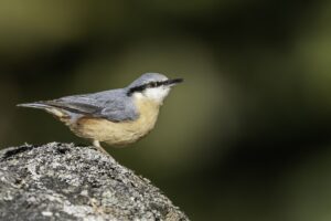
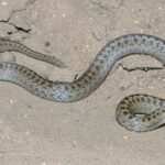
161 species recorded on the island
Highlights


Island specials


All wildlife
Loading all 161 species…
Nothing on the list is usually seen this month.
Recordings from Wikimedia Commons, under Creative Commons licences; hover a Listen button for the recordist. Sightings are records shared with GBIF since 2000.
Watching wildlife responsibly. Keep your distance from seals, seabird colonies and cetaceans, stay quiet, and never feed or chase wildlife. See the WiSe Scheme guidance for watching marine wildlife.


