





Strangford Lough
92 islands · Ireland
Island Passport
How many of the 92 islands in Strangford Lough can you collect?
0 of them collected by explorers so far
Strangford Lough, on the east coast of County Down in Northern Ireland, is the largest sea inlet in the British Isles, covering about 150 square kilometres. It is almost cut off from the Irish Sea by the Ards Peninsula, joined to the open sea only by the Narrows, a channel about eight kilometres long between Strangford and Portaferry, through which the whole tide of the lough pours in and out twice a day. The name comes from the Old Norse Strangfjörthr, “the fjord of the strong current”.
Landscape
The lough is famous for its islands. Its main body holds at least seventy islands and many smaller islets, known locally as pladdies, most of them drumlins: smooth, whale-backed hills of glacial clay left by the ice sheets and later drowned by the rising sea. The islands are thickest along the western shore, between Comber and Killyleagh, where Mahee Island, Sketrick Island, Islandmore and Island Taggart lie among a maze of smaller islets, channels and sheltered anchorages. At low tide great sweeps of mudflat appear at the northern end of the lough, near Newtownards, and around the islands of the inner shore.

The islands
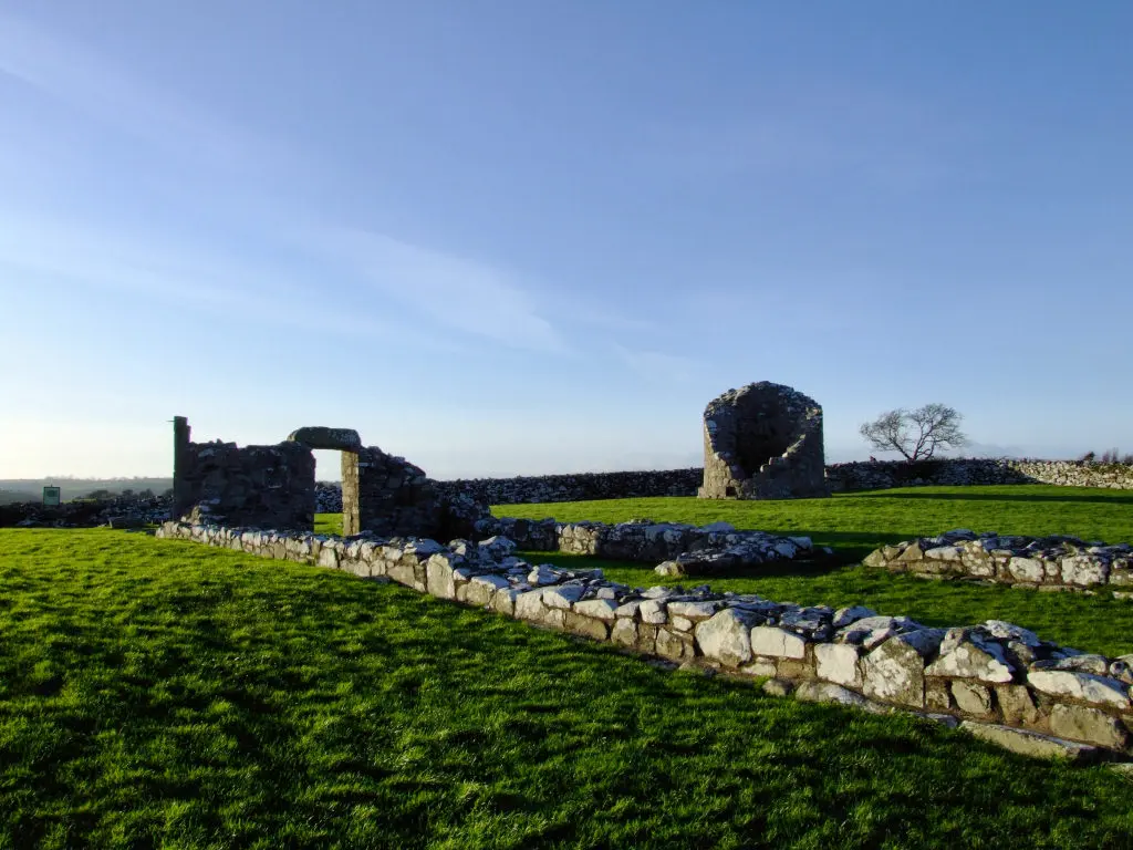
Each island has its own character. Mahee Island holds Nendrum Monastery, one of the most important early Christian sites in Ireland, with its round tower, three rings of stone walls and one of the oldest excavated tide mills in the world. Sketrick Island has the ruins of a tower house that once guarded the causeway to the mainland. Gores Island, near the mouth of the Quoile, was farmed until its last resident, Jane Spratt, died there in 1910 at the age of 98. Smaller islands such as Reagh, Rainey, Trasnagh, Dunsy, Pawle and Simmy are quiet drumlins of grass and scrub, while Angus Rock, at the mouth of the Narrows, waited more than 260 years for its lighthouse to be lit.

History
People have lived around the lough for thousands of years. Early Christian monks founded Nendrum on Mahee Island, traditionally in the 5th century, and the Vikings, whose ships used the lough, gave it its name. After the Anglo-Norman invasion John de Courcy and his followers built castles and abbeys along its shores: Grey Abbey, a Cistercian house founded in 1193 by de Courcy’s wife Affreca, still stands on the eastern shore, and tower houses such as Sketrick, Kilclief and Strangford Castle guarded the lough and the Narrows. Killyleagh Castle, on the western shore, is often said to be one of the oldest inhabited castles in Ireland.
Wildlife
Strangford Lough was designated as Northern Ireland’s first Marine Nature Reserve in 1995, and it is one of the richest wildlife sites in Ireland. Each winter around three quarters of the world’s pale-bellied brent geese arrive from Arctic Canada to feed on the eelgrass of its mudflats, along with huge flocks of knot, golden plover, redshank and other waders and wildfowl. Common seals breed on the quiet shores of the islands, grey seals haul out near the Narrows, and basking sharks are sometimes seen in summer. The powerful currents of the Narrows support a remarkable variety of sea life, from sponges and anemones to soft corals.
More about Strangford Lough
The same currents that make the Narrows so rich made the lough a pioneer of marine energy: in 2008 SeaGen, the world’s first commercial tidal stream turbine, was installed in the channel near Portaferry. The National Trust looks after much of the lough’s shore and many of its islands, and its great houses, Mount Stewart on the eastern shore and Castle Ward near Strangford, have gardens and walks running down to the water. Scrabo Tower, on its hill above Newtownards, gives a famous view over the whole lough and its islands.
Visiting
The Strangford to Portaferry ferry has crossed the Narrows for almost four centuries, running every half hour or so and taking about ten minutes. Mahee Island and Sketrick Island can be reached by road from Comber and Killinchy, and Nendrum Monastery is free to visit. Most of the other islands are private or uninhabited, but they can be explored by kayak, sailing boat or on organised boat trips, and the Strangford Lough Canoe Trail links campsites around the shore. The tides run very fast in the Narrows and the mudflats can be soft, so take local advice before heading out. Every island here can be collected in your Island Passport.
The biggest islands in Strangford Lough
By area (acres)
- 1 Mahee Island 176
- 2 Reagh Island 138
- 3 Islandmore 132
- 4 Island Taggart 92
- 5 Gores Island 90
- 6 Conly Island 68
- 7 Pawle Island 61
- 8 Salt Island 56
- 9 Rainey Island 42
- 10 Chapel Island, Greyabbey 36
Every island in Strangford Lough
 Island No.
952
Not yet collected
Saltwater
Angus Rock
Strangford Lough
Angus Rock is a small skerry at the entrance to Strangford Lough, about a mile east of Kilclief on the Ards Peninsula.…
 Island No.
1,018
Not yet collected
Saltwater
Ballyhenry Island
Strangford Lough
Ballyhenry Island is a small island in Strangford Lough, County Down, about 2.2 kilometres from Portaferry, in the eastern part of the…
Island No.
1,056
Not yet collected
Saltwater
Beardy Rocks
Strangford Lough
Beardy Rocks is a small rocky islet in Strangford Lough, County Down, about 1.7 kilometres from Strangford, in the eastern part of…
Island No.
1,035
Not yet collected
Saltwater
Bird Island, Killyleagh
Strangford Lough
Bird Island, Killyleagh is a small islet in Strangford Lough, County Down, about 3.8 kilometres from Killyleagh, in the southern part of…
Island No.
1,000
Not yet collected
Saltwater
Bird Island, Kircubbin
Strangford Lough
Bird Island, Kircubbin is a small islet in Strangford Lough, County Down, about 3.0 kilometres from Kircubbin, in the eastern part of…
Island No.
992
Not yet collected
Saltwater
Bird Island, Whiterock
Strangford Lough
Bird Island, Whiterock is a small islet in Strangford Lough, County Down, about 2.8 kilometres from Whiterock, in the western part of…
Island No.
1,036
Not yet collected
Saltwater
Black Island, Strangford Lough
Strangford Lough
Black Island, Strangford Lough is a small rocky islet in Strangford Lough, County Down, about 2.1 kilometres from Castle Espie, in the…
Island No.
1,015
Not yet collected
Saltwater
Black Rock
Strangford Lough
Black Rock is a small rocky islet in Strangford Lough, County Down, about 2.7 kilometres from Ringhaddy, in the western part of…
Island No.
984
Not yet collected
Saltwater
Boretree Island East
Strangford Lough
Boretree Island East is a small islet in Strangford Lough, County Down, about 2.1 kilometres from Mount Stewart, in the northern part…
Island No.
985
Not yet collected
Saltwater
Boretree Island West
Strangford Lough
Boretree Island West is a small islet in Strangford Lough, County Down, about 2.3 kilometres from Mount Stewart, in the northern part…
Island No.
999
Not yet collected
Saltwater
Bradock Island
Strangford Lough
Bradock Island is a small islet in Strangford Lough, County Down, about 0.7 kilometres from Whiterock, in the western part of the…
Island No.
1,054
Not yet collected
Saltwater
Bush Island
Strangford Lough
Bush Island is a small rocky islet in Strangford Lough, County Down, about 2.2 kilometres from Ringhaddy, in the western part of…
Island No.
998
Not yet collected
Saltwater
Calf Island
Strangford Lough
Calf Island is a small islet in Strangford Lough, County Down, about 1.1 kilometres from Whiterock, in the western part of the…
Island No.
986
Not yet collected
Saltwater
Chanderies
Strangford Lough
Chanderies is a small islet in Strangford Lough, County Down, about 2.6 kilometres from Mount Stewart, in the northern part of the…
 Island No.
990
Not yet collected
Saltwater
Chapel Island, Greyabbey
Strangford Lough
Chapel Island, Greyabbey is a small island in Strangford Lough, County Down, about 3.0 kilometres from Greyabbey, in the eastern part of…
 Island No.
1,019
Not yet collected
Saltwater
Chapel Island, Portaferry
Strangford Lough
Chapel Island, Portaferry is a small island in Strangford Lough, County Down, about 3.1 kilometres from Portaferry, in the eastern part of…
 Island No.
1,004
Not yet collected
Saltwater
Conly Island
Strangford Lough
Conly Island is a small island in Strangford Lough, County Down, about 1.7 kilometres from Whiterock, in the western part of the…
Island No.
1,001
Not yet collected
Saltwater
Craigaveagh Rock
Strangford Lough
Craigaveagh Rock is a small rocky islet in Strangford Lough, County Down, about 1.7 kilometres from Whiterock, in the western part of…
 Island No.
994
Not yet collected
Saltwater
Cross Island
Strangford Lough
Cross Island is a small island in Strangford Lough, County Down, about 2.5 kilometres from Whiterock, in the western part of the…
Island No.
1,007
Not yet collected
Saltwater
Darragh Island
Strangford Lough
Darragh Island is a small island in Strangford Lough, County Down, about 1.7 kilometres from Ringhaddy, in the western part of the…
Island No.
1,016
Not yet collected
Saltwater
Dodd’s Island
Strangford Lough
Dodd’s Island is a small islet in Strangford Lough, County Down, about 2.1 kilometres from Killyleagh, in the western part of the…
Island No.
1,003
Not yet collected
Saltwater
Drummond Island
Strangford Lough
Drummond Island is a small island in Strangford Lough, County Down, about 2.8 kilometres from Ringhaddy, in the western part of the…
Island No.
1,044
Not yet collected
Saltwater
Duck Rock
Strangford Lough
Duck Rock is a small rocky islet in Strangford Lough, County Down, about 3.2 kilometres from Whiterock, in the western part of…
 Island No.
1,017
Not yet collected
Saltwater
Dunnyneill Islands
Strangford Lough
Dunnyneill Islands is a small islet in Strangford Lough, County Down, about 2.4 kilometres from Killyleagh, in the western part of the…
