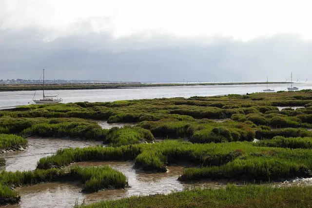
Northey Island
Island Passport
Collect Northey Island
Be the first to collect it
Tidal island. Stamps are never worth a risky crossing. Check official safe crossing times and local signs before walking out.
Northey Island lies in the Blackwater Estuary in Essex, about a mile east of the town of Maldon, a tidal island roughly 1.5 kilometres square, connected to the mainland by a causeway covered by the tide for up to three hours either side of high water.

It is one of just six Essex tidal islands that can be walked to directly from the British mainland, part of a small, distinctive group of estuarine islands scattered along this stretch of coast.
History
Northey Island is widely believed to be the site of the Battle of Maldon, fought in 991 AD between Anglo-Saxon defenders led by the ealdorman Byrhtnoth and a Viking raiding force, an engagement famous today largely through the surviving Old English poem that commemorates it, one of the great works of Anglo-Saxon literature and a rare near-contemporary account of a specific, datable battle from this period of English history.

In the early 18th century, the Dutch contractor Nicholas Van Cropenrough carried out significant land reclamation on Northey Island, considerably enlarging its usable area, though much of this gained ground was lost again to coastal flooding in 1897. The writer Norman Angell, a Nobel Peace Prize laureate, bought the island in 1923, and it has been managed by the National Trust since, forming part of the Blackwater Estuary Site of Special Scientific Interest.
Wildlife and area
Northey’s birdlife has long been notable: the local place name Awl Creek preserves the old Essex dialect word for avocet, a bird strongly associated with this stretch of coast, while the island’s last recorded raven was taken from the Ladies Grove there in 1888. Today Northey supports Grey Seal, Harbour Seal, Common Tern and Oystercatcher, part of the rich wildlife of the wider Blackwater Estuary, close to other notable Essex islands including Canvey Island.
Tides
Now
—
Next high water
—
Next low water
—
Not for crossing. These are modelled tide heights, not safe crossing times. Tidal causeways and sands can flood quickly: always check the official safe crossing times and local signs before walking out.
Heights in metres relative to mean sea level; times are UK time. Not for navigation. Tide model: Open-Meteo (CC BY 4.0).
How to get to Northey Island
You can reach Northey Island on foot.
On foot, over the causeway
You can walk to Northey Island at low tide. The way across floods quickly as the tide turns: check the safe crossing times and local signs, and never cross on a rising tide.
Plan your trip
Timetables change, so always check with the operator before you travel. We may earn a commission if you book through some of these links, at no extra cost to you.
Wildlife
113 species recorded on the island
Highlights
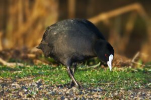


All wildlife
Loading all 113 species…
Nothing on the list is usually seen this month.
Recordings from Wikimedia Commons, under Creative Commons licences; hover a Listen button for the recordist. Sightings are records shared with GBIF since 2000.
Watching wildlife responsibly. Keep your distance from seals, seabird colonies and cetaceans, stay quiet, and never feed or chase wildlife. See the WiSe Scheme guidance for watching marine wildlife.